Maps
Geographic, Political, & Economic Maps of Grantville and its surroundings.
Click on an image to open full size version.
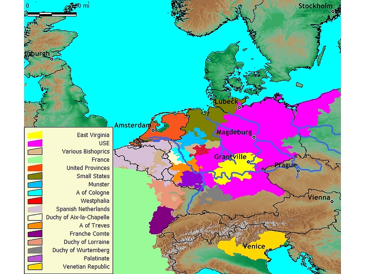
Europe in the 1632 Universe
Map of Europe showing faction territories in the 1632 Universe.
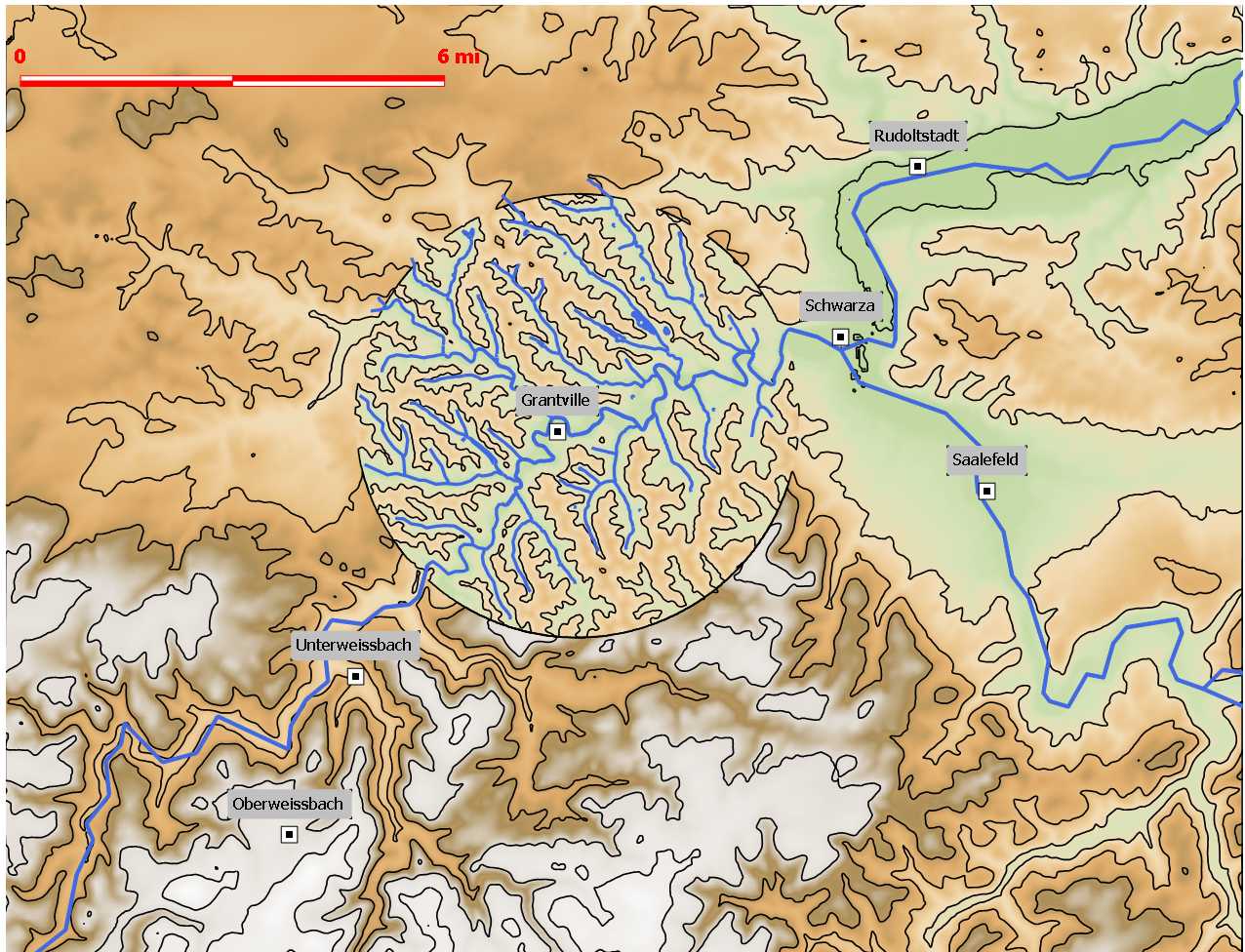
Thuringia After ROF
Topographical map of Grantville & surrounding areas in Thuringia province post-Ring of Fire.
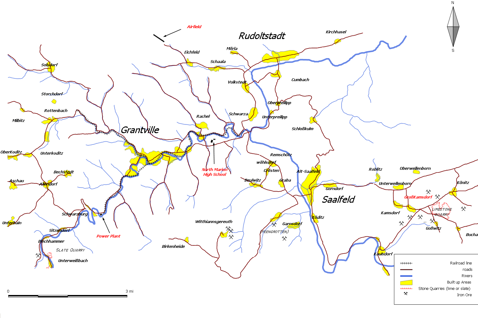
Grantville
Detail map of Grantville and surrounding areas.
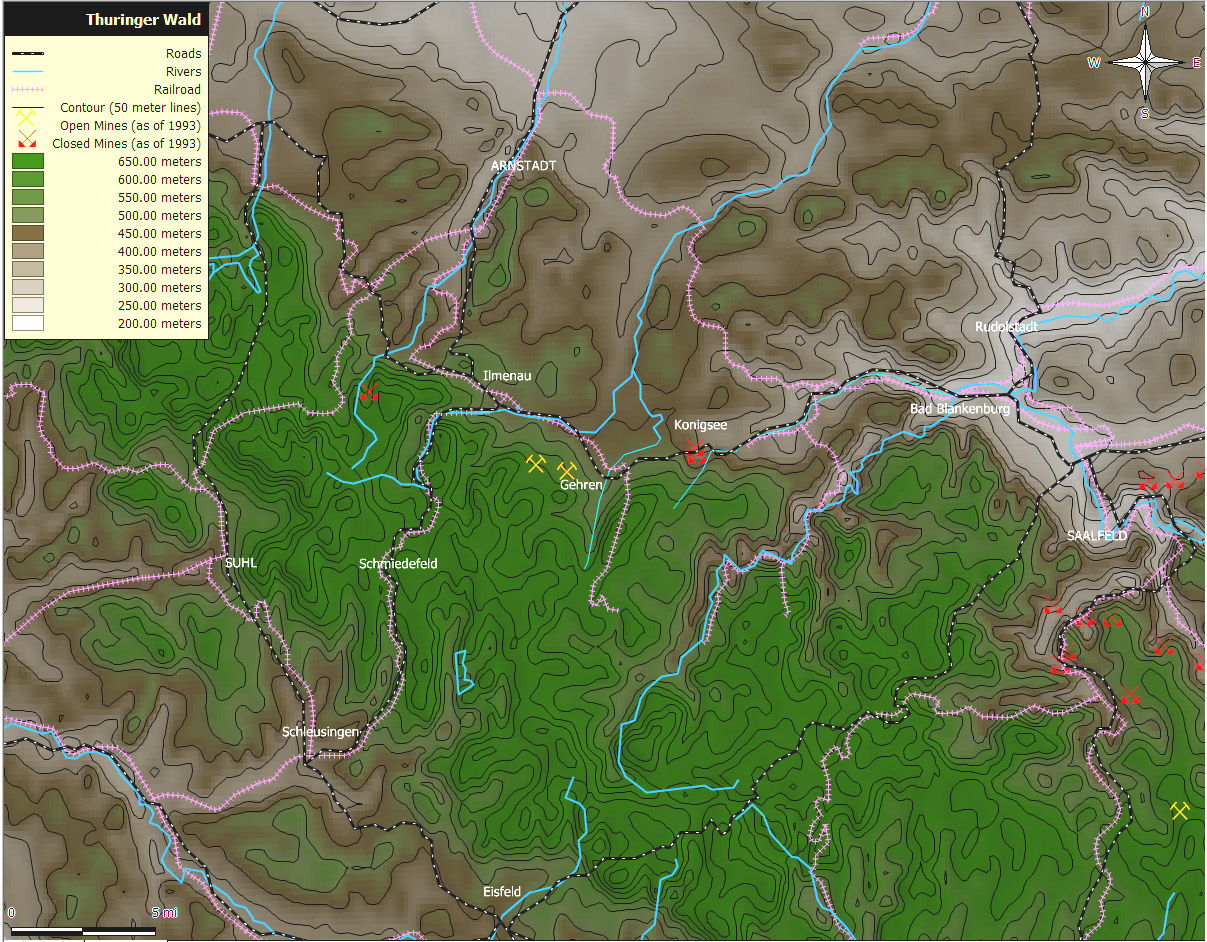
Thuringer Wald
Topographical map of Thuringer Wald forest.
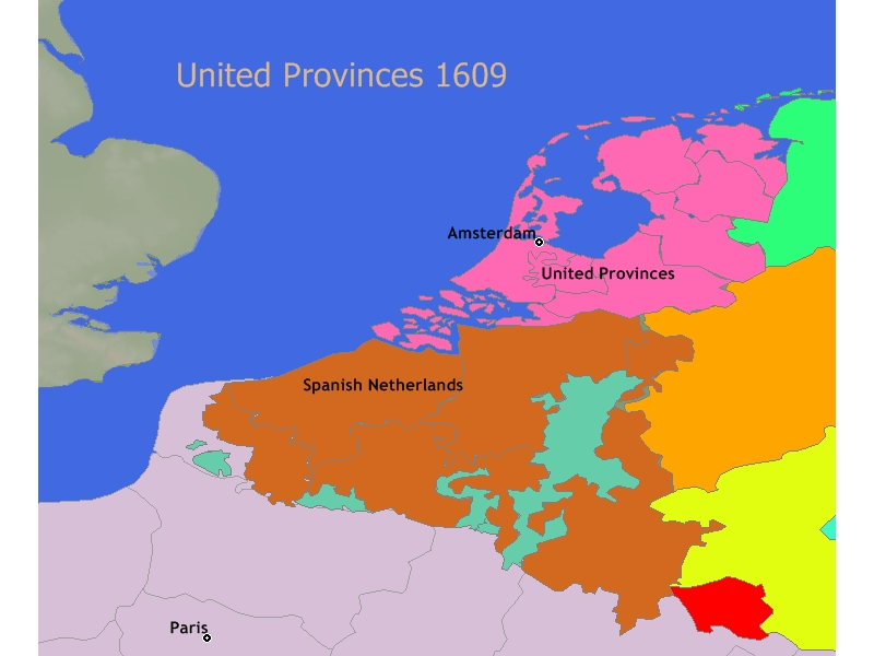
United Provinces of 1609
Map of territories at the start of the Twelve Years’ Truce in 1609.

3D Map of Grantville
Three dimensional topographical map of Grantville.
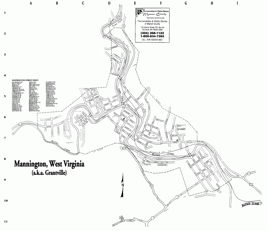
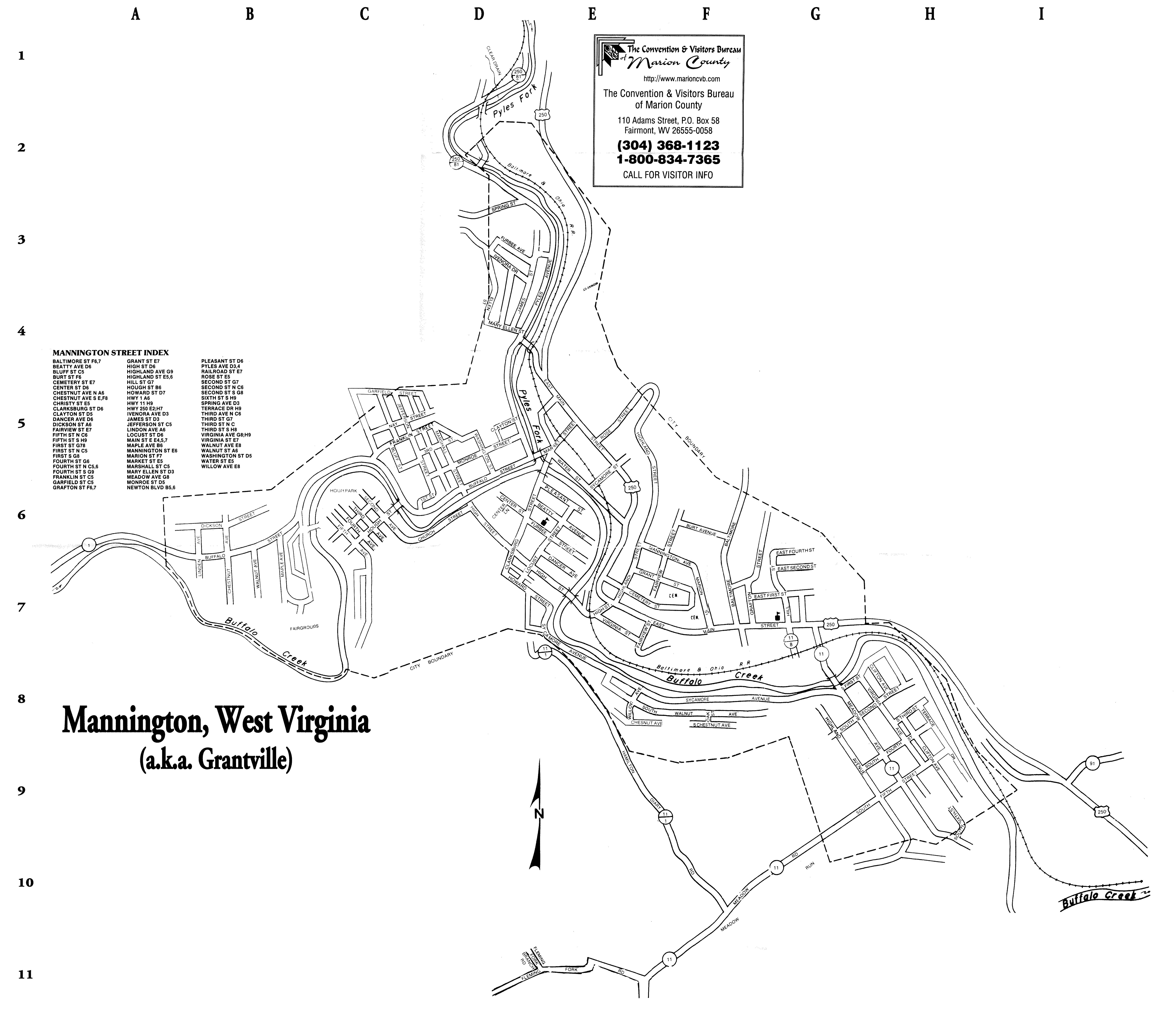
Mannington, West Virginia
Remember, Grantville is not Mannington, but the geography of the two is strangely similar. To download a high resolution version of this map click here.
The Tower of London
Maps of the Tower in the period of the Ring of Fire and surrounding areas. Read more about the history of tower hill. To view a high-resolution zoom-able version of the 1572 Braun/Hogenberg map courtesy of the British Library click here.
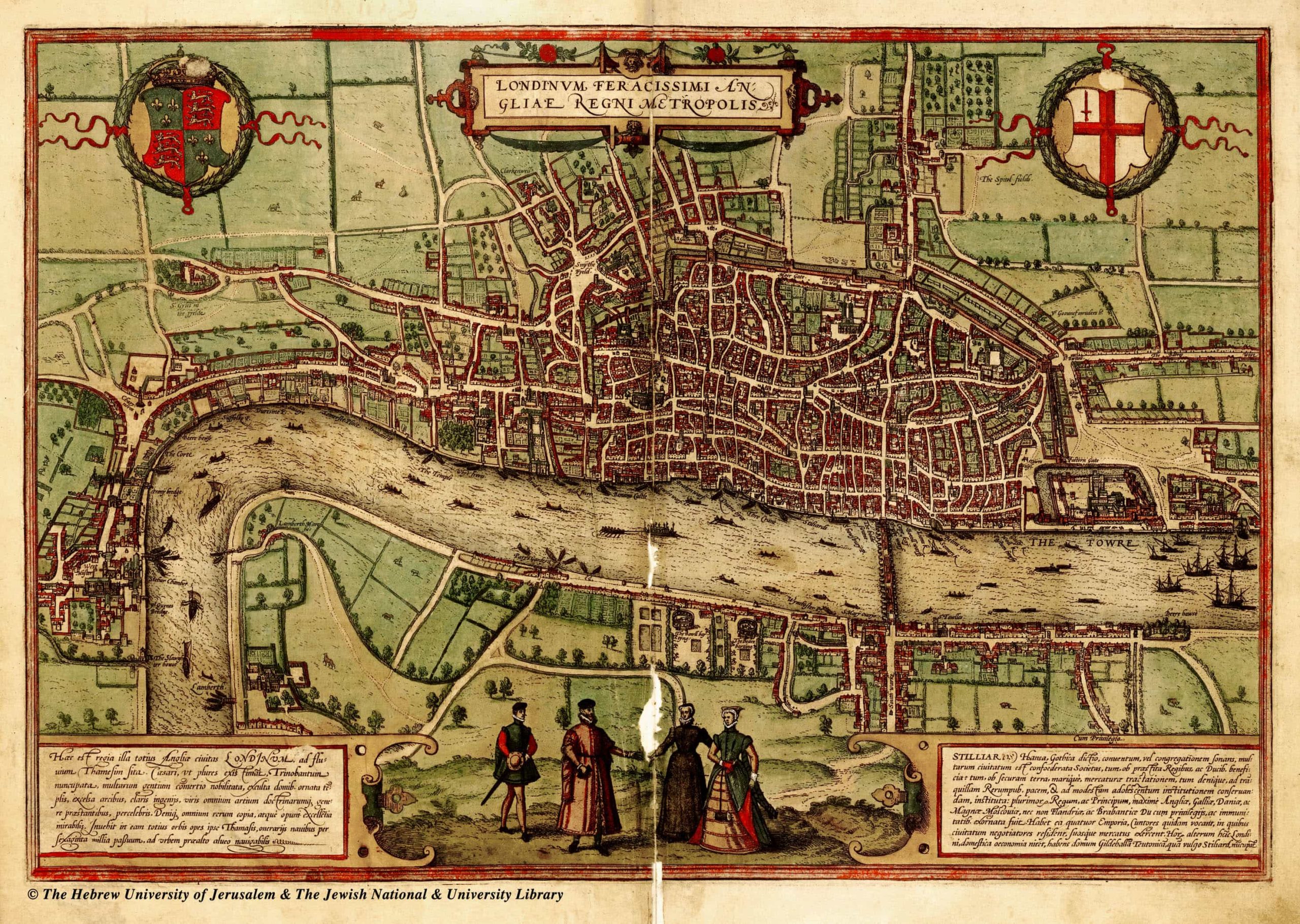
Civitates Orbis Terrarum, 1572
The earliest known map of London. By Braun and Hogenberg.
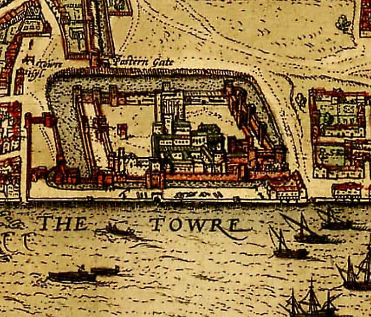
Tower Hill
Enlargement of the Tower of London from the 1572 Braun/Hogenberg map.
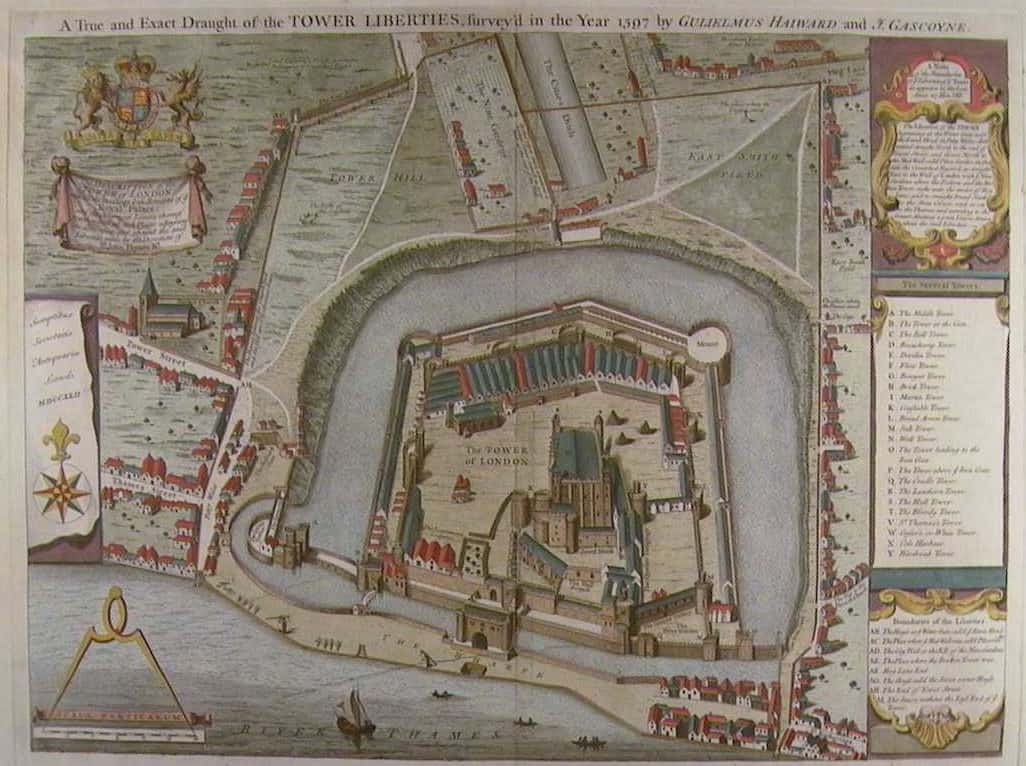
Tower Liberties
Map of the Tower Liberties surveyed by Haiward & Gascoyne in 1597.
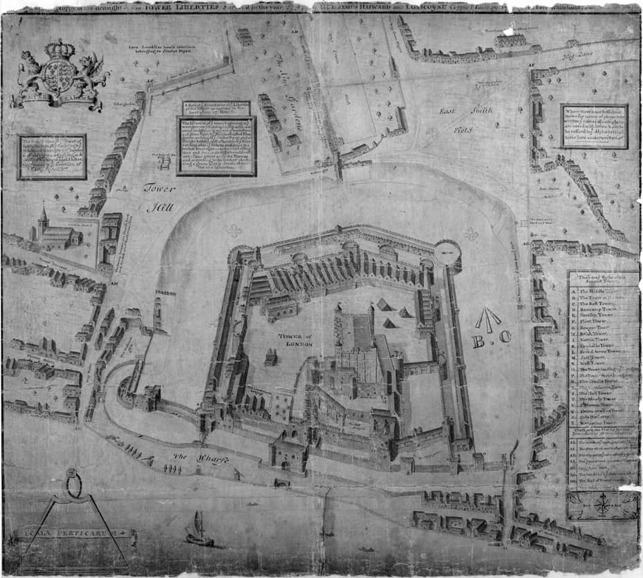
1713 Copy
1713 copy of Haiward/Gascoyne by Robert Whitehand.
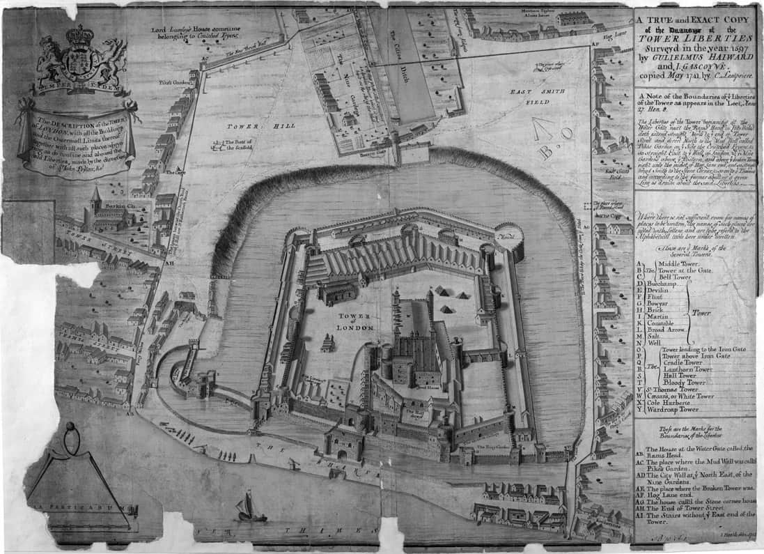
1752 Copy
1752 Copy of Haiward/Gascoyne by Joseph Heath.
Money Maps
The Money Maps illustrate Gorg Huff’s ideas about the spread of acceptance of the New US Dollar.
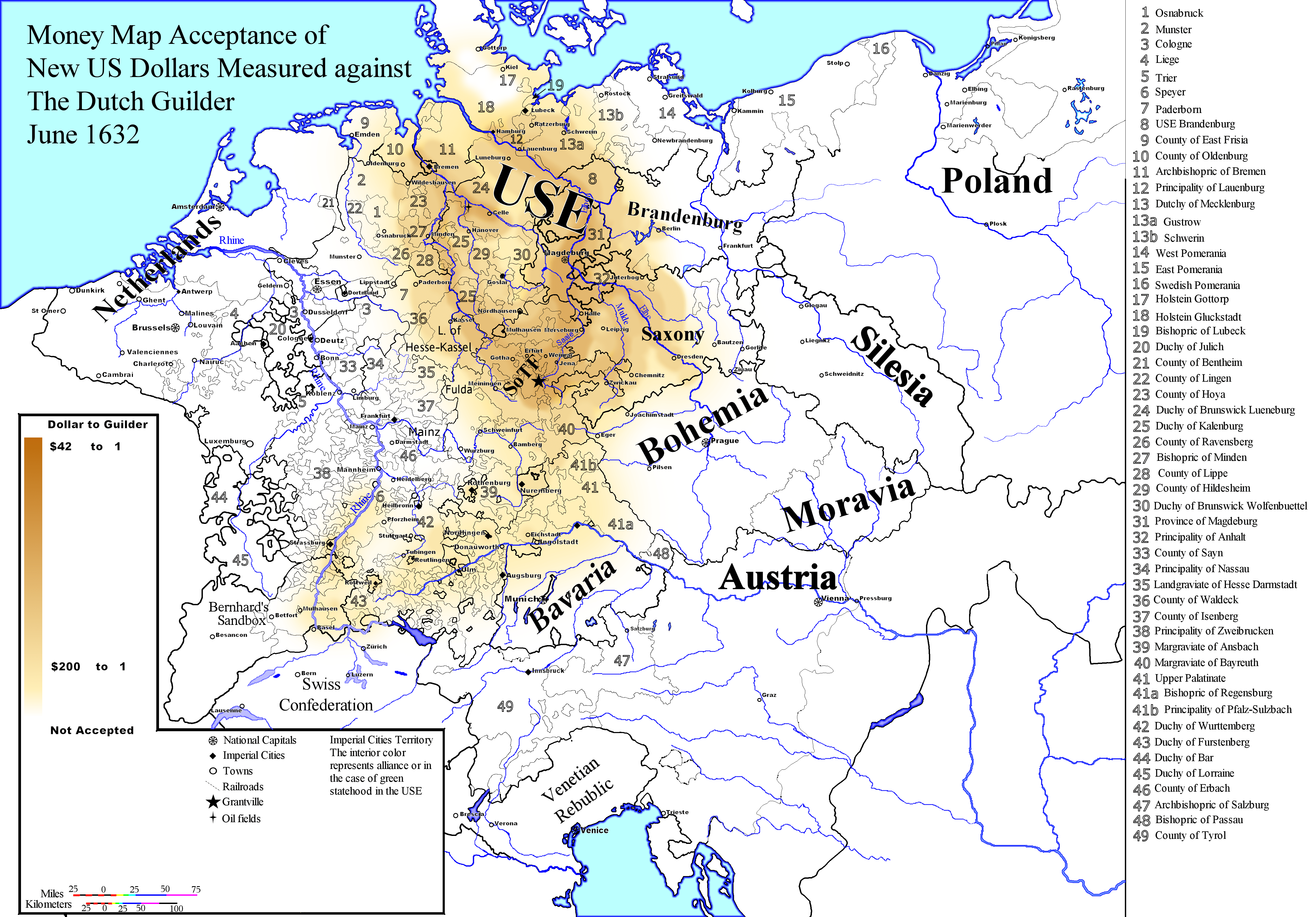
June 1632
New US Dollars vs Dutch Guilder
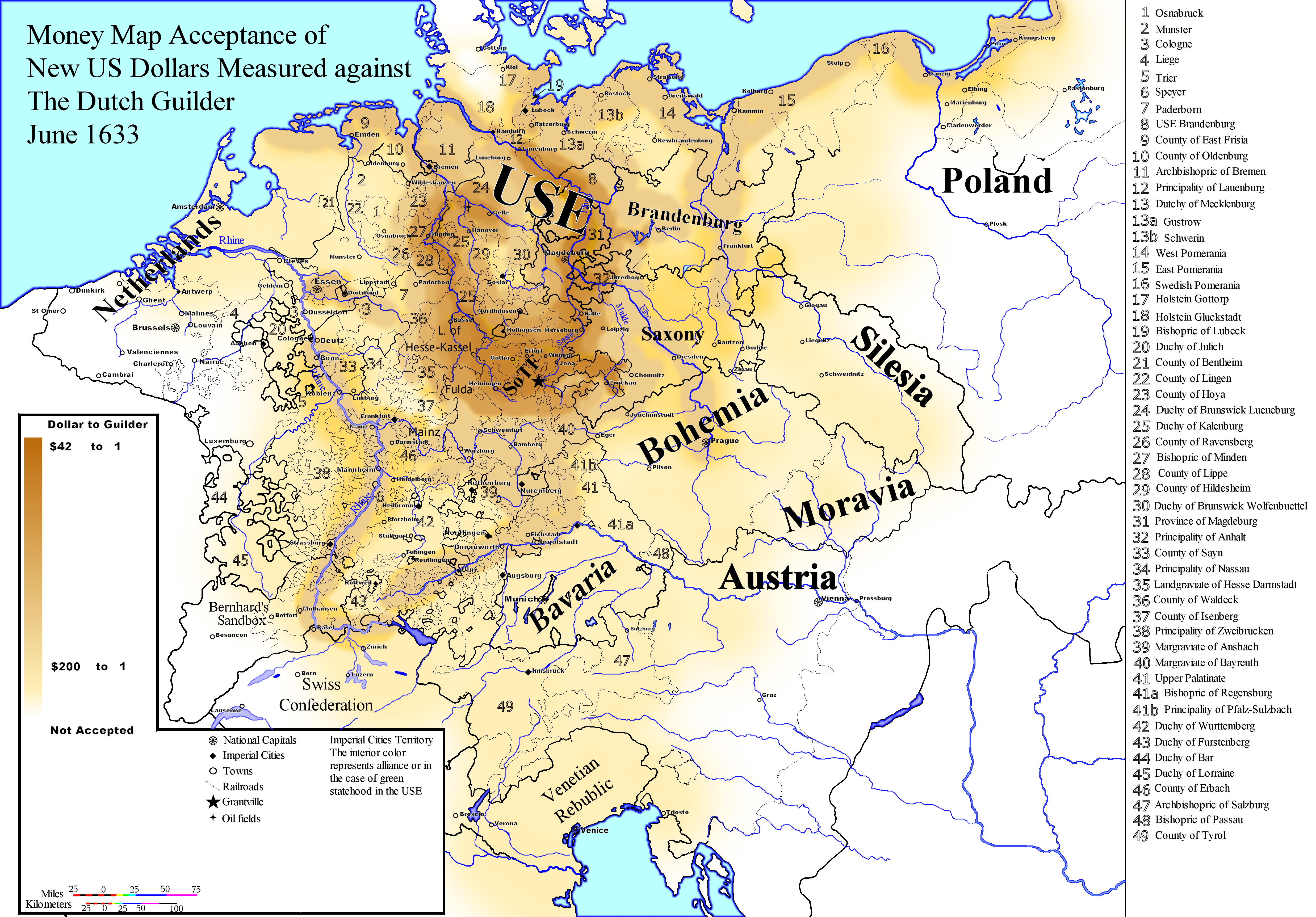
June 1633
New US Dollars vs Dutch Guilder
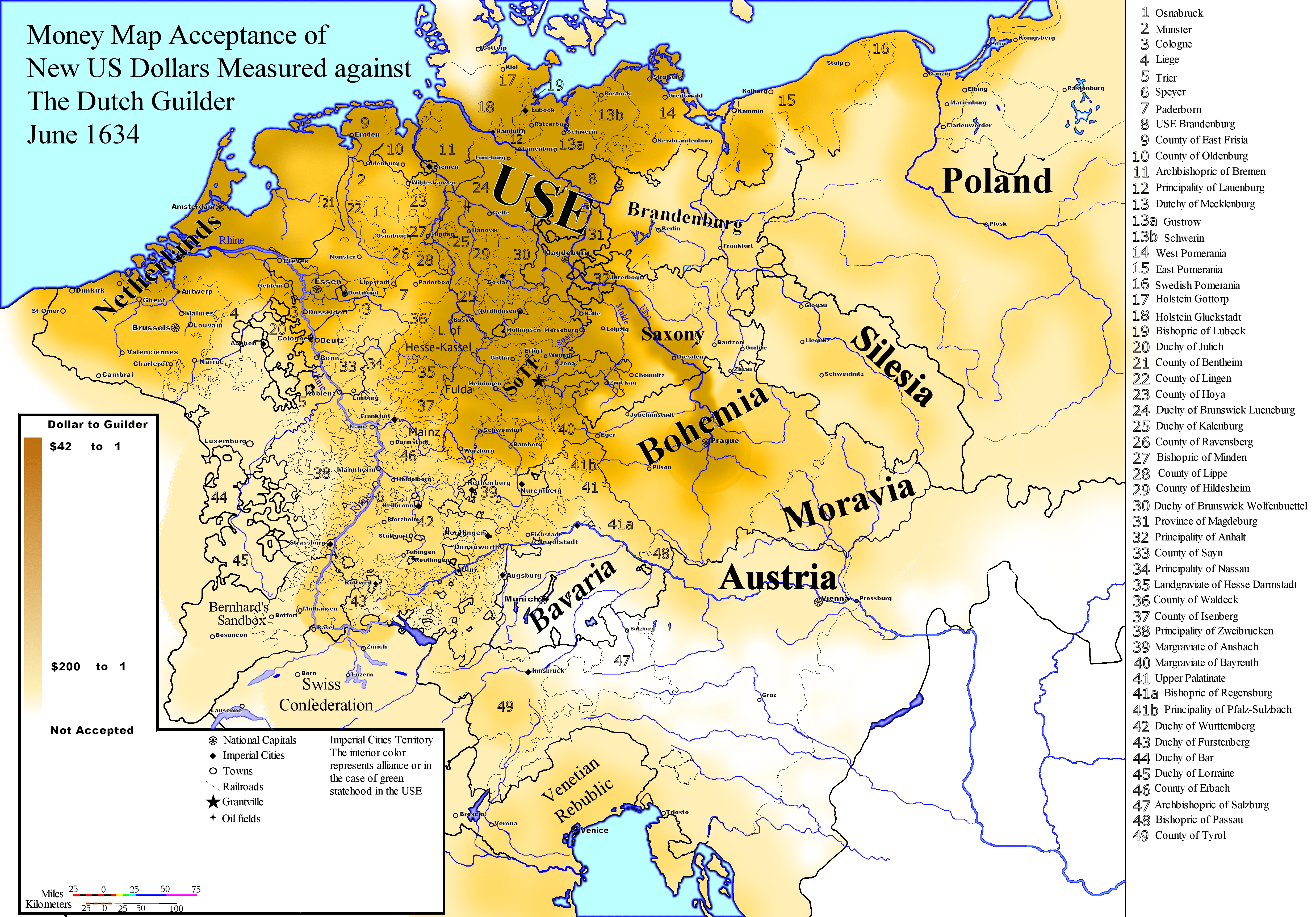
June 1634
New US Dollars vs Dutch Guilder
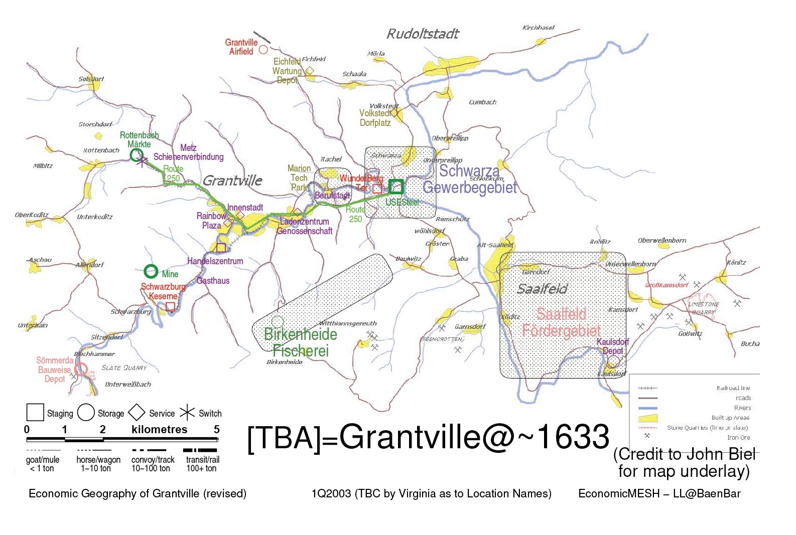
Grantville Economy
Economic map of Grantville ca. 1633.
Topographic Maps
Mike Barthelemy’s 1632 topographic maps which provide a view of the Grantville area inserted into the proper part of Thuringia and rotated so that the edges match the descriptions in 1632.
Political Maps
Mike Nagle has been making a series of high resolution political maps at or soon after the Ring of Fire. You can download or preview them at Mike’s Map Page here on 1632.org
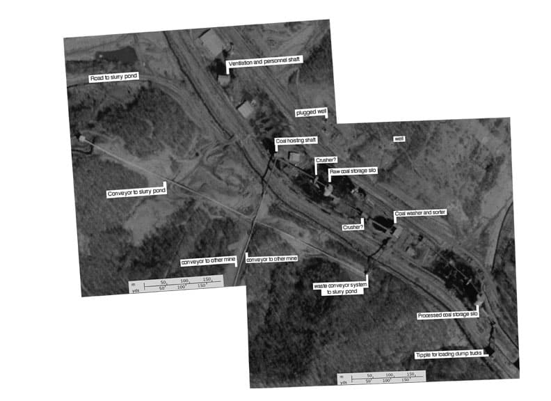
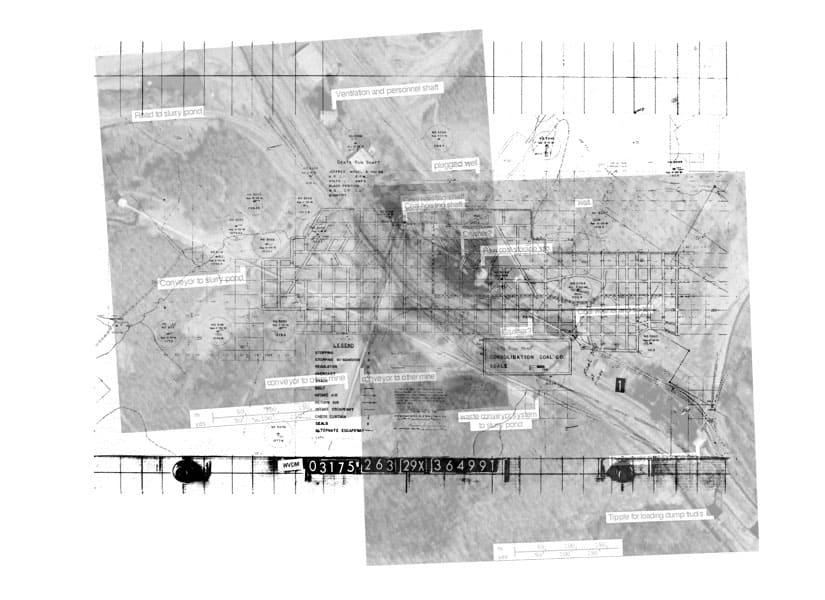
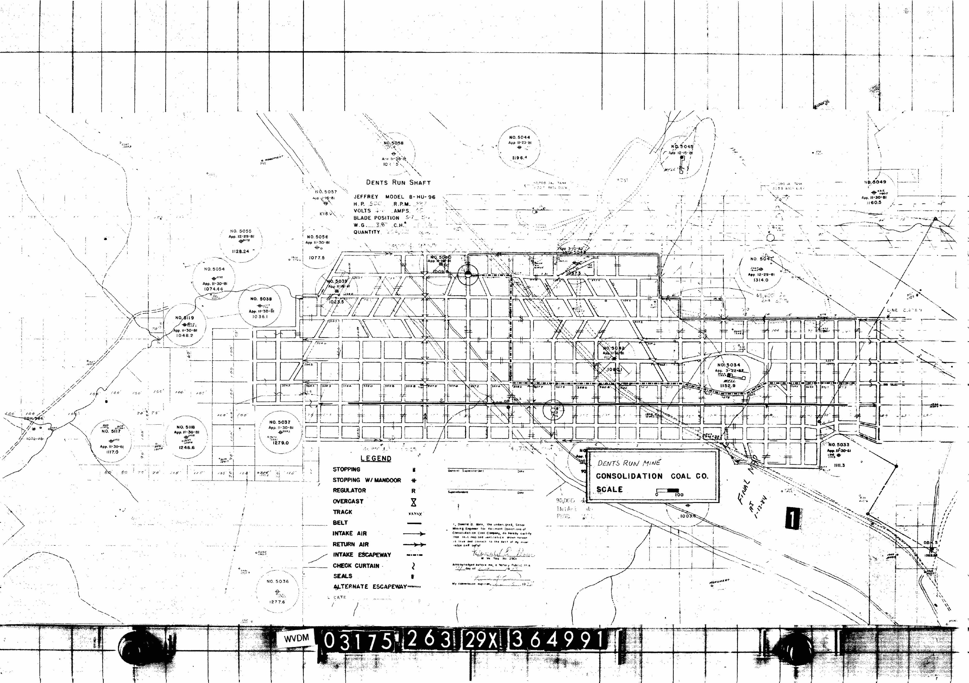
Dent’s Run Mine
Some maps sent by Mark Huston. I think they are an adjunct to his story Twenty-Eight Men, but his email didn’t say. He did say “The satellite photos were provided by Doug Jones, the map is from the WV state mining website, where they have a public archive of all closed mines. This is the mine that is the model for the coal mine in 1632 and is within the ROF.”
| Thumbnail | Title | Author | DateUpdated |
|---|---|---|---|
| Dent’s Run combo Did a little Photoshop, and we have a good view of the above ground layout relative to the below ground activity at the time the mine was closed. | Mark Huston | 2006-11-26 | |
| Dent’s Run Final The satellite photos were provided by Doug Jones. | Mark Huston | 2006-11-26 | |
| Dent’s Run map The map is from the WV state mining website, where they have a public archive of all closed mines. | Mark Huston | 2006-11-26 |
Links to other Maps
Large map of Europe This is a ZIP archive of large format map of Europe, sliced into pages. Print them, some tape and presto, a loverly map, perfect for the myopic.
Old Maps Online A collection of sixty-thousand historic maps with a googlemapish interface. You can zoom in/out on the globe and pick a timerange with a slider. The sidebar on the right lists a selection of maps within the area you’re viewing. Mousing over an item in the list will show a bounding box on the main map which will be helpful for people who don’t read the language the original was titled in. You can view the historic map, and some maps can be viewed as a overlay on top of the modern map. Very cool.